
Lassen Volcanic is a US National Park in northern California. Compared to its more popular centrally located siblings, such as Yosemite or Sequoia Parks, Lassen is a much smaller, less advertised, and seemingly remote park. In fact the driving time from San Francisco to Lassen is about the same as to Yosemite.
The highest point of the Park is Lassen Peak (10457 ft / 3187 m) – a dormant volcano that is at least partially covered with snow all the year round, and that had the last major eruption in 1915, devastating the nearby forest and spitting out the volcanic ashes over tens of miles. The second largest is Brokeoff Mountain (aka Mount Tehama, 9239 ft / 2816 m).
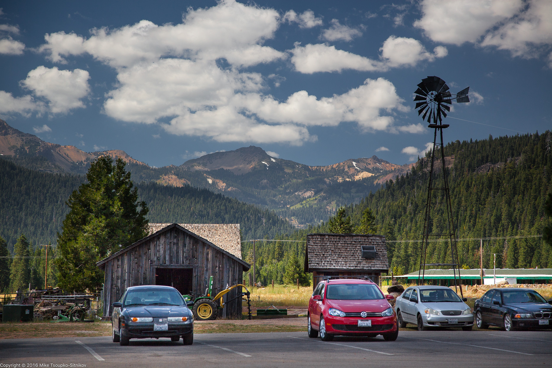
Brokeoff Mountain, center, as seen from Childs Meadow a few mile south from the Park entrance:
Lassen Peak Ascent
Ascent or climb are probably not the best terms to describe this not very difficult hike. The round trip is under 5 miles / 8 km, and the elevation gain is about 2000 ft / 600m.
 Click on the image for more details or to download the GPX track
The trail starts at the Lassen Peak trailhead parking lot off Lassen Peak Highway. Just before we got to the trailhead we stopped by Lake Helen less than half a mile away next to the Highway. As we stepped out of the car we immediately felt lucky we had packed some warm layers. The temperatures were in the 40°s (below 10°C) and there was snow on the ground and ice on the lake. Just for reference, it was early July, and down in the Central Valley it was 90°+F – about 30°C.
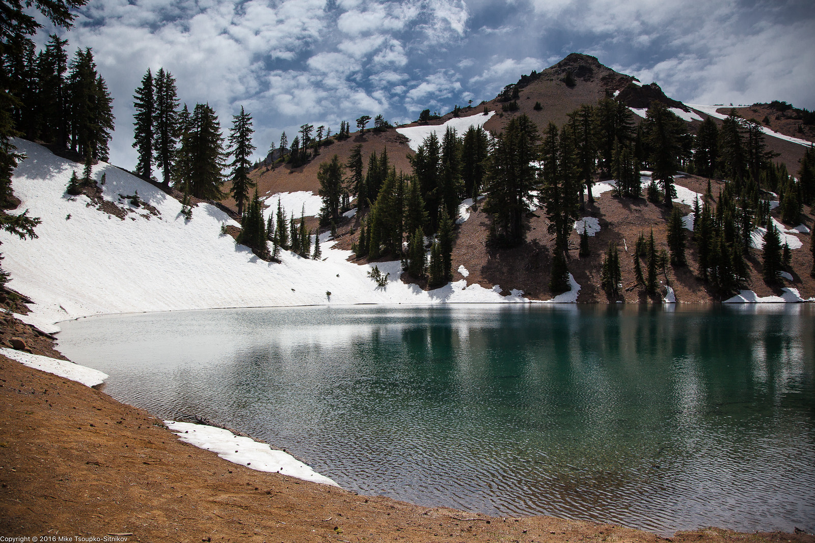
Lake Helen in July with Brokeoff Mountain in the background:

Once in the parking lot we put on the down jackets and gloves and took off on the trail. For the first half-mile or more it was more or less gentle slope with few switchbacks:

After that the trail started following the edge separating the west and east faces of the mountain, and the switchbacks became way more frequent. As we gained the elevation, the panoramic views started to open up.
Half-way there and looking south-east. In the center, Reading Peak; far away, Lake Almanor:

Looking to the south-west, we see Lake Helen, the Lassen Peak Highway, the parking lot at the trailhead where we started, and lots of mountains and snow:

We hike on. The trail becomes a little steeper, and the weather becomes warmer, although more windy. I have to tighten the strap of my hat under my chin to prevent it from flying away. The patches of snow on the trail become more frequent:

Eventually we end up on a plateau about 1/4 mile /0.5km long, mostly covered with snow, but this is not the summit yet. The plateau is framed by black volcanic rocks looking like solidified lava, which they probably are, and the summit is on the top of the tallest of these rocks. We have to cross the plateau via a narrow path in the snow:


Getting up from the plateau onto the summit rock is as close to climbing as it gets during this hike. The last 60ft / 20m probably require some borderline category 4 effort, depending on how you approach the summit (it’s bare rock with no marked trail).
Once at the top we are rewarded by 360° views of Lassen Park and tens of miles of surrounding Cascade Range mountains:


The horizon was too misty to let us see the snow-capped Mount Shasta up north. After a few minutes of high altitude euphoria and a snack we head back. The whole round trip including the rest at the top and multiple stops for pictures takes us less than 3.5 hours. This means we have time for more hikes, and we head west on Lassen Peak Highway to the Ridge Lake trailhead.
Ridge Lake Trail
The Ridge Lake Trail starts at the Sulfur Works parking lot off Lassen Peak Highway. The roundtrip is about 2.6 miles / 4 km and the elevation gain is 1000ft / 300m.

Click on the image for more details or to download the GPX track
The trail is fairly steep and provides a good exercise. It mostly goes through the forest, and does not offer any nice views it until you reach Ridge Lake, which is where the trail ends:
But on the way back we’re walking with our back to the hillside and facing the valley, and we discover that there are indeed some good views and photo opportunities. We get a glimpse the Diamond Peak, named so for oddly shaped lava rocks at its top, and a view of Lassen Peak Highway making its way through blossoming meadows:


When the trails gets close to Sulfur Creek our noses tell us where does the name of the creek come from. We walk in the direction of the sulfuric smell and see two small sulfur pits, a few feet in diameter each, filled with hot water and god knows what cocktail of minerals and acids:


However when we get back to the trailhead and check out the Sulfur Works area we see the real stuff – the pits with dark, smelly, boiling and burping goo that looks like hot liquid cement and smells like rotten eggs:

Soon though our olfactory systems get used to the smell and stop registering it, and we just stand there and relax looking at the weird landscape created by geothermal forces.

Echo Lake Hike
This is a short and pretty hike that features two lakes, an enchanted pine forest and superb views of the Lassen Peak. The round trip is 4 miles (6.4 km) and the elevation gain is 760ft / 230m.

Click on the image for more details or to download the GPX track
The trails starts at Summit Lake North campground right off Lassen Peak Highway in the northeastern part of the park. Right at the trailhead one gets the first view of this hike – that of Lassen Peak over Summit Lake:

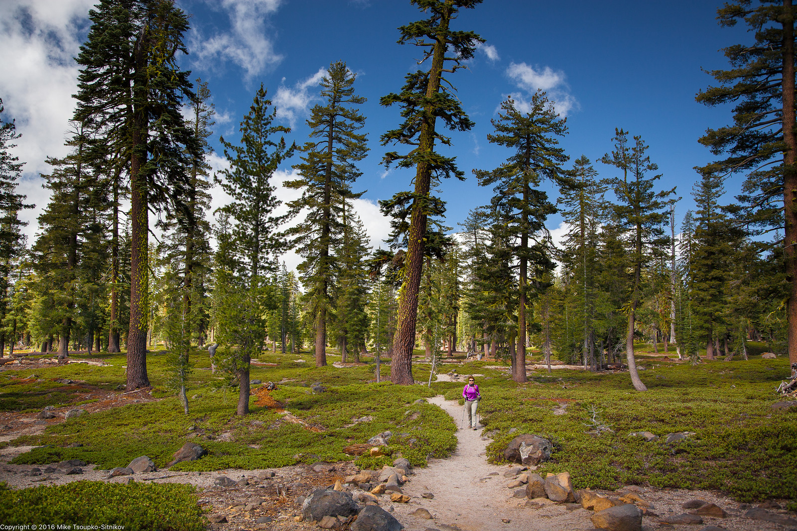
The trail starts in a dense and dark patch of the forest but after gaining some elevation it goes through a beautiful sparse forest with plenty of light:
A little more elevation gain and there is another majestic view of Lassen Peak:

A few minutes later the trails reaches the Echo Lake, sleepy and serene:

There is an option to keep going deeper into the woods following the same trail – and there are dozens of lakes along it. Many people backpack towards these lakes for overnight camping. The other option is to trace one’s steps back to the trailhead.
Kings Creek to Cold Boiling Lake to Bumpass Hell
Bumpass Hell is a geothermal area full of colorful boiling pits and malodorous vapors. The clouds of vapor resemble smoke, and the smell of sulfur invokes the image of Hell. It’s called Bumpass after an unlucky 19th century fellow of the same name who discovered this area and got his foot scolded in the process.
Most visitors get there via a trail that starts at the trailhead on the Lassen Peak Highway between Emerald Lake and Lake Helen. However a ranger at the Park entrance told us that Bumpass Hell Trail was closed because it was still covered with much snow and was unsafe (This turned out not to be true – the trail open for the season on that very day). We were disappointed at first, since Bumpass was one of our destinations, but then we decided to try a longer trail that start at Kings Creek Picnic Area a few miles to the east.

Click here or on the image for trip info, detailed map and downloadable GPX track
The first ~0.8 miles / 1.2 km are flat and easy, and I think we even saw people with very small kids and strollers. This stretch of the trail ends at Cold Boiling Lake. It is called so because of bubbles of gas raising from its bottom in several locations, producing an illusion of boiling. These bubbles were too small to be captured with the zoom lens I had on me at the time. Other than the bubbles the lake is quite nondescript.
We took the trail that went counterclockwise around the lake and started to ascend the slope of the ridge on its opposite shore. In about half an hour the trail became more or less level and we finally started getting some views on the left (south) side of the trail:
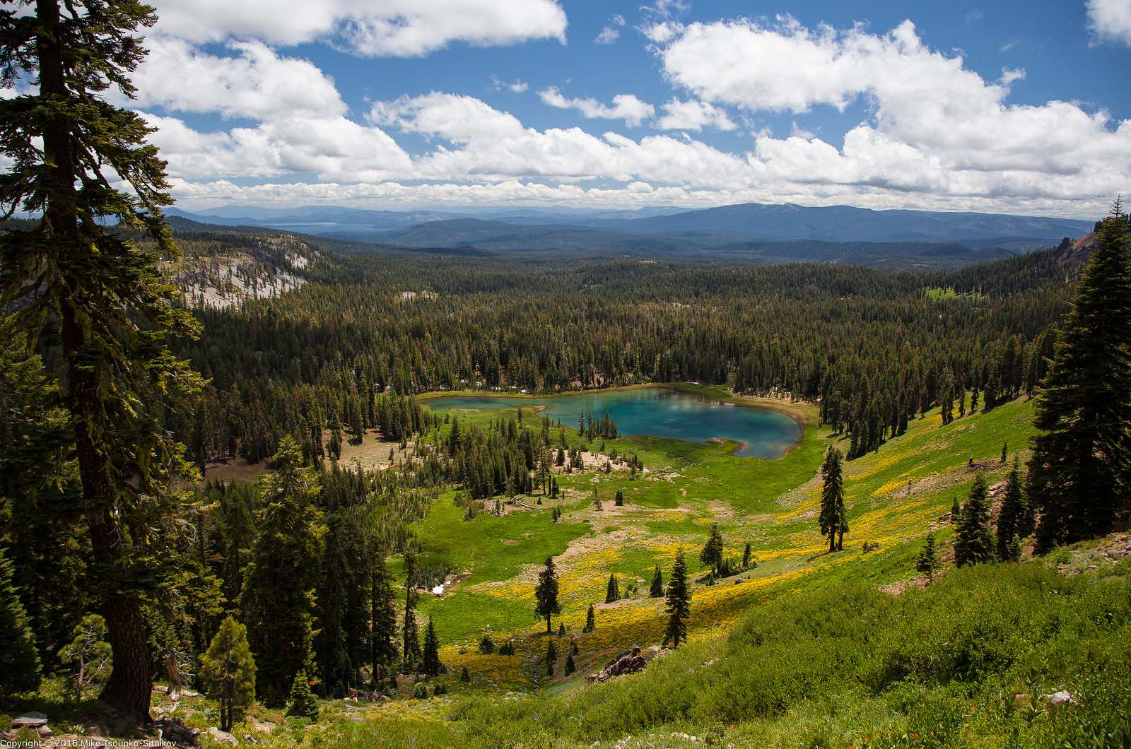
Crumbaugh Lake and the mountains of Cascade Range as seen from Bumpass Hell Trail:
Then the trail turned north and we saw the Brokeoff Mountain…

… and the southern part of the park with Lake Almanor far south:

After a few more switchbacks and a few snow patches the trail finally got us to Bumpass Hell. It didn’t look particularly hellish, probably because it was a windy day and the vapor clouds were scattered by the wind:

As we got closer the situation got more smoky and smelly:


We were tempted to leave the walkway and walk on the ground but upon careful consideration decided against it:

And a few more shots from Bumpass Hell:


We got out of the Hell alive, and traced our steps back to Kings Creek through the scenery that looked more like hiker’s version of Paradise:

Devil’s Kitchen
Devils Kitchen is another geothermal area in Lassen, similar to Sulphur Works and Bumpas Hell, larger than the former and probably a bit smaller than the latter. There is no access to it from Lassen Peak Highway rather than by a strenuous multi-hour hike through the forest. A more realistic option is to drive for about an hour south to Lake Almanor, and then take a narrow road that heads from Chester to Drakesbad Ranch within the Park. The road becomes unpaved at some point, but is still quite passable when dry. The whole drive is about 1 hour.
Drakesbad Ranch is a resort featuring a few tiny cabins, a cafeteria and a horse ranch where one can book horseback rides. It looks very remote and must be a good place to meditate and get some rest from mobile phones and internet. This place is located on the Pacific Crest Trail and we saw several PCT hikers (these folks are easy to spot and tell from the day visitors) replenishing their supplies at the food counter or sipping a drink in the shade.
The round trip from Drakesbad to Devil’s Kitchen is about 5 miles / 8km on a more or less flat terrain.
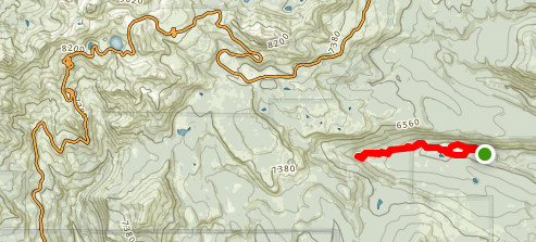
Click for more details or to download the GPX track
The Devils Kitchen has its fair share of hot muddy pits, vapor clouds and sulfuric smell, so it deserves the name. If you ask me though whether the place itself is worth driving and hiking to, I would say not if you’ve seen Bumpass Hell and Sulfur Works.


Childs Meadow
Childs Meadow is a beautiful meadow, located to the south of Lassen Park on Highway 36, about 10 minutes drive from the Park Entrance. It features a open range pastures, with grazing cows here and there, and the upscale Highlands Ranch Resort that features bucolic view of the pastures, panoramas of Lassen Park peaks, cabins for guests and a nice dining room with a full bar and a huge fireplace.


Related posts: Yosemite in September
Related galleries: Lassen Volcanic Park

With a picture, it says looking eastwards. But you see chaos crags in front of you so that’s looking north
LikeLiked by 1 person
Could be. Which picture do you mean?
LikeLike
A Beautiful look at the nature I love
LikeLike